Map
Tactical mapping, built on your real CAD
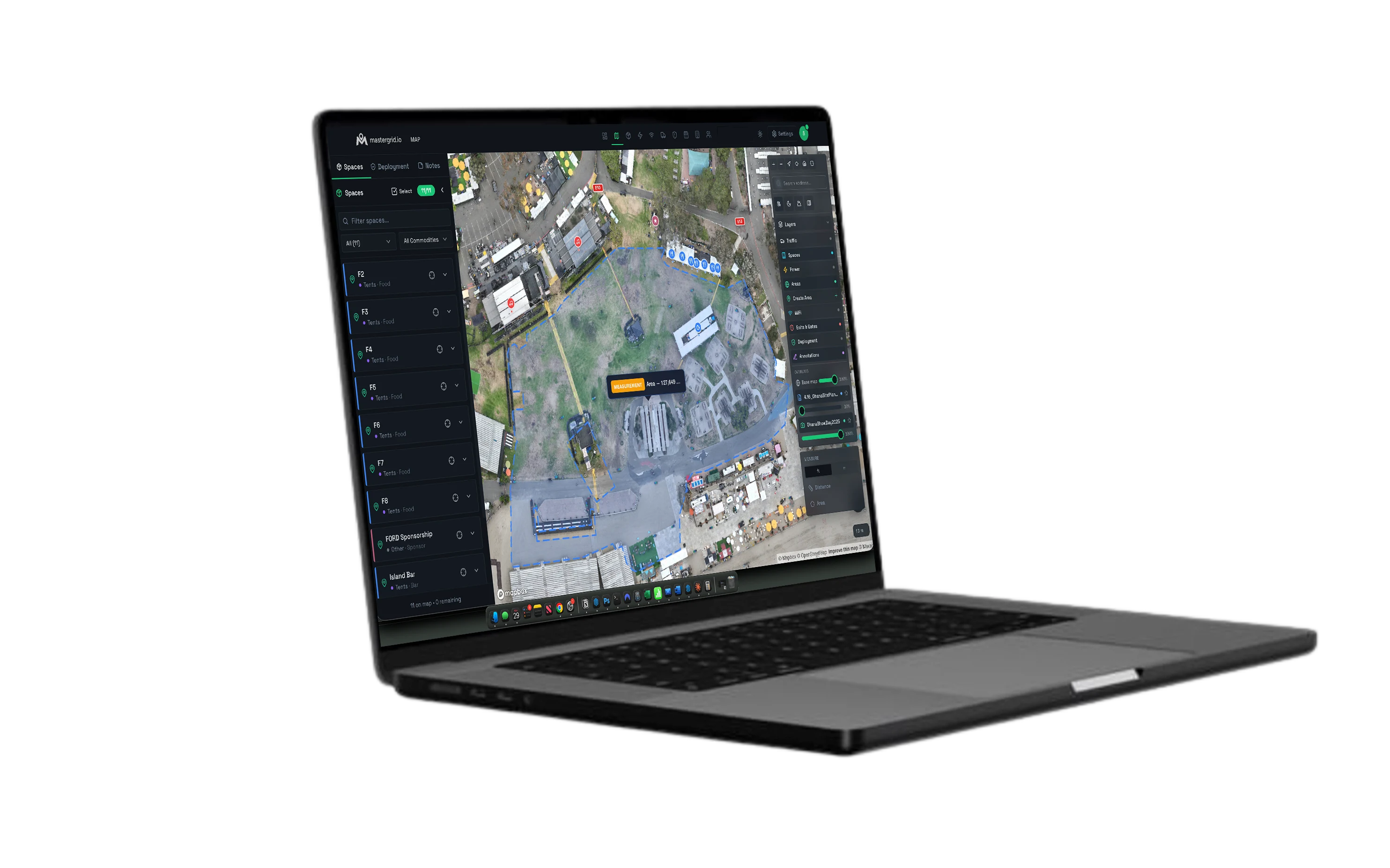
Map brings your geo-referenced CAD and as-built drone imagery into one live site plan — real situational awareness for the whole team, not a pin dropped on outdated Google Maps. We work with the tools you already use. We never replace your CAD.
Import
Built on the drawings you already have
Drag and drop your geo-referenced schematics from AutoCAD, Vectorworks, or SketchUp, and layer in as-built drone imagery from DroneDeploy. Minutes later your team is working from the real site — every gate, every dimension — instead of a pin dropped on a stale Google Map. Updating the plan is one more drag-and-drop.
- AutoCAD CAD schematics
- Vectorworks CAD & design
- SketchUp 3D site models
- DroneDeploy As-built drone imagery
How it works
Easy as 1, 2, 3
Create your CAD
Drag & drop into MasterGrid
Publish to your team
Notes & annotations
Mark it up, measure, revise — right on the map
Measure an area or a cable run, drop a note, flag a change — directly on the live plan. Revision and annotation tools that keep everyone on the current version, not a printout from three weeks ago.
- Measure area
- Measure distance
- Drop a note
- Mark a revision
11,445 sq ft (1,063 m²)
62 ft
Field GPS
Find yourself on the CAD site plan
Put your real-time GPS position on the CAD plan and answer the only question that matters in the field: where am I? Accurate to within a foot — enough to get a crew to the right gate, fast.
Layers
Every layer, one plan
See and manage every layer on one CAD site plan — security DOT placements, power distribution, deployments, WiFi, exits and gates. Toggle what you need; hand the right view to the right team.
More in Map
One plan, fully under your control
Your plan is a security asset
High-res imagery on demand
FAQ
Questions teams ask
What can I import into Map?
Does MasterGrid replace my CAD software?
How accurate is the in-field GPS?
Can I control who sees the site plan?
Can I buy higher-resolution aerial imagery?
Ready to deploy?
We're onboarding a limited cohort of operations teams for the 2026 season. Priority goes to festivals, venues, and major event operators.